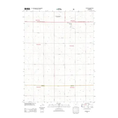
2013 Map of Stoneham
USGS Topo · Published 2013About this map
Stoneham serves as the primary settlement hub in this northeastern Colorado landscape, situated along State Hwy 14 where it meets Marble Ave. The high plains terrain is defined by the expansive Pawnee National Grassland, which dominates the northern portion of the quadrangle. For genealogists and local historians, the Prairie View Cem stands north of the main township, providing a specific point of interest for family researchers.
Find a feature on this map
36 named features on this map. Tap any name to fly to it.
Don’t see what you’re looking for? This feature index may not catch every label — zoom into the map to look around manually.
Map Details
Editions of this 2013 Stoneham Map
This is the sole edition of this map. No revisions or reprints were ever made.
Other maps of this area

1951 · Dead Horse Springs
USGS Topo · 1:24,000

1951 · Antelope Springs
USGS Topo · 1:24,000

1951 · Peace Valley School
USGS Topo · 1:24,000

1954 · Sterling
USGS Topo · 1:250,000

1958 · Sterling
USGS Topo · 1:250,000

1977 · Stoneham
USGS Topo · 1:24,000

1977 · Stoneham NE
USGS Topo · 1:24,000

1977 · Raymer NE
USGS Topo · 1:24,000

1978 · Stoneham NW
USGS Topo · 1:24,000
1978 · Raymer
USGS Topo · 1:24,000