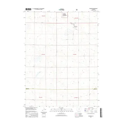
2016 Map of Stoneham
USGS Topo · Published 2016About this map
Stoneham anchors this high-plains landscape, situated near the northern edge of the map where local thoroughfares like Flint Ave and Granite Ave intersect. The terrain is defined by a grid of rural roads and section lines that trace the transition from agricultural land into the Pawnee National Grassland at the northern boundary. Just west of the settlement, the Prairie View Cem serves as a significant local landmark for genealogical research. The map also delineates the jurisdictional divide between Weld Co and Morgan Co in the south, illustrating how the regional survey system has organized the open country into distinct townships such as t7n r56w and t8n r57w.
Find a feature on this map
31 named features on this map. Tap any name to fly to it.
Don’t see what you’re looking for? This feature index may not catch every label — zoom into the map to look around manually.
Map Details
Editions of this 2016 Stoneham Map
This is the sole edition of this map. No revisions or reprints were ever made.
Other maps of this area

1951 · Dead Horse Springs
USGS Topo · 1:24,000

1951 · Antelope Springs
USGS Topo · 1:24,000

1951 · Peace Valley School
USGS Topo · 1:24,000

1954 · Sterling
USGS Topo · 1:250,000

1958 · Sterling
USGS Topo · 1:250,000

1977 · Stoneham
USGS Topo · 1:24,000

1977 · Stoneham NE
USGS Topo · 1:24,000

1977 · Raymer NE
USGS Topo · 1:24,000

1978 · Stoneham NW
USGS Topo · 1:24,000
1978 · Raymer
USGS Topo · 1:24,000