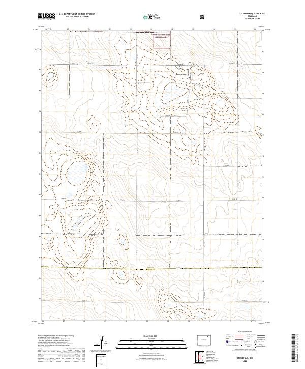
2022 Map of Stoneham
USGS Topo · Published 2022About this map
Stoneham serves as the central hub of this eastern plains landscape, situated near the northern edge of the survey area. The settlement is defined by a traditional grid including Marble Ave and Granite Ave, positioned just south of the Pawnee National Grassland. This 2022 survey illustrates the intersection of local commerce and public lands, with the Prairie View Cem providing a vital point of reference for genealogists and local historians. The surrounding terrain is organized by an extensive network of county roads, such as Co Rd 86 and Co Rd 145, which trace the section lines typical of the high plains ranching and farming country. A significant geographic boundary is noted at the southern end where Weld Co meets Morgan Co, following the path of Co Rd 55.
Find a feature on this map
31 named features on this map. Tap any name to fly to it.
Don’t see what you’re looking for? This feature index may not catch every label — zoom into the map to look around manually.
Map Details
Editions of this 2022 Stoneham Map
This is the sole edition of this map. No revisions or reprints were ever made.
Other maps of this area

1951 · Dead Horse Springs
USGS Topo · 1:24,000

1951 · Antelope Springs
USGS Topo · 1:24,000

1951 · Peace Valley School
USGS Topo · 1:24,000

1954 · Sterling
USGS Topo · 1:250,000

1958 · Sterling
USGS Topo · 1:250,000

1977 · Stoneham
USGS Topo · 1:24,000

1977 · Stoneham NE
USGS Topo · 1:24,000

1977 · Raymer NE
USGS Topo · 1:24,000

1978 · Stoneham NW
USGS Topo · 1:24,000
1978 · Raymer
USGS Topo · 1:24,000