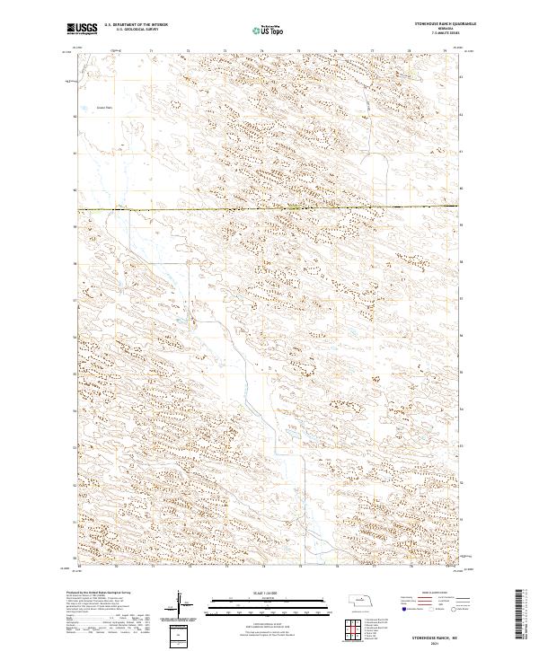
2021 Map of Stonehouse Ranch
USGS Topo · Published 2021About this map
Gracie Flats dominates the northwestern portion of this terrain, located along the boundary of Rock and Loup Counties. The landscape is defined by the winding course of Gracie Cr, which flows south through the central sections of the survey. This 2021 update reflects the sparse, ranch-oriented development of the Nebraska Sandhills, where movement is facilitated by a grid of numbered roads including 455th Ave and 460th Ave. These corridors provide access through several townships, such as t25n r17w and t24n r17w, where large-scale cattle ranching remains the primary land use. The map illustrates the characteristic topographic undulations and isolated water features that define this remote region of the Great Plains.
Find a feature on this map
12 named features on this map. Tap any name to fly to it.
Don’t see what you’re looking for? This feature index may not catch every label — zoom into the map to look around manually.
Map Details
Editions of this 2021 Stonehouse Ranch Map
This is the sole edition of this map. No revisions or reprints were ever made.
Other maps of this area

1952 · Taylor NW
USGS Topo · 1:24,000

1952 · Burwell NW
USGS Topo · 1:24,000

1952 · Taylor NE
USGS Topo · 1:24,000

1955 · Broken Bow
USGS Topo · 1:250,000

1955 · O'Neill
USGS Topo · 1:250,000

1956 · Broken Bow
USGS Topo · 1:250,000

1959 · O'Neill
USGS Topo · 1:250,000

1969 · O'Neill
USGS Topo · 1:250,000

1981 · Bruner Lake
USGS Topo · 1:24,000

1981 · Stonehouse Ranch NW
USGS Topo · 1:24,000