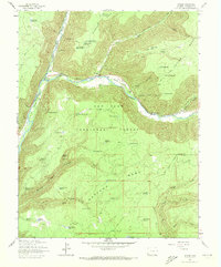
1963 Map of Stoner
USGS Topo · Published 1972About this map
Stoner sits at the confluence of the Dolores River and the West Dolores River, serving as a central point in this mountain landscape during the early 1960s. The settlement's role as a recreational and administrative hub is evidenced by the Stoner Ski Area and the Stoner Guard Station. Winding along the river valley, the Dolores Railroad Grade marks the path of former narrow-gauge infrastructure that once connected these high-country communities.
Find a feature on this map
91 named features on this map. Tap any name to fly to it.
Don’t see what you’re looking for? This feature index may not catch every label — zoom into the map to look around manually.
Map Details
Editions of this 1963 Stoner Map
4 editions found

Other maps of this area

1895 · La Plata
USGS Topo · 1:62,500

1897 · La Plata
USGS Topo · 1:62,500

1897 · Rico
USGS Topo · 1:62,500

1898 · Rico
USGS Topo · 1:62,500

1899 · La Plata
USGS Topo · 1:62,500

1899 · Rico
USGS Topo · 1:62,500

1908 · La Plata
USGS Topo · 1:62,500

1956 · Cortez
USGS Topo · 1:250,000

1958 · Cortez
USGS Topo · 1:250,000

1959 · Cortez
USGS Topo · 1:250,000