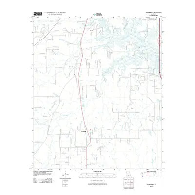
2012 Map of Stonewall
USGS Topo · Published 2012About this map
Stonewall and Keithville anchor this part of DeSoto and Caddo Parishes, showing the transition from rural land to residential development south of Shreveport. The landscape is defined by the winding paths of Boggy Bayou, Buchanan Bayou, and Cypress Bayou, which historically dictated the placement of roads and early homesteads. Resource extraction is a primary feature of the southern portion of the map, dominated by the Caspiana Gas Field. Local landmarks like the Powell Cem offer specific points of interest for genealogists, while aviation history is represented by small private strips including Old Hickory Ranch Airport and Bluebird Hill Airport. The settlement at Staples and the newer developments at Wildwood South illustrate the area's growth patterns along the primary north-south corridors.
Find a feature on this map
146 named features on this map. Tap any name to fly to it.
Don’t see what you’re looking for? This feature index may not catch every label — zoom into the map to look around manually.
Map Details
Editions of this 2012 Stonewall Map
This is the sole edition of this map. No revisions or reprints were ever made.
Other maps of this area

1941 · Forbing
USGS Topo · 1:31,680

1945 · Grand Cane
USGS Topo · 1:62,500

1945 · Greenwood
USGS Topo · 1:62,500

1945 · Mansfield
USGS Topo · 1:62,500

1947 · Mansfield
USGS Topo · 1:62,500

1948 · Caspiana
USGS Topo · 1:62,500

1955 · Shreveport
USGS Topo · 1:250,000

1955 · Shreveport East
USGS Topo · 1:24,000

1955 · Caspiana
USGS Topo · 1:62,500
1955 · Shreveport West
USGS Topo · 1:24,000