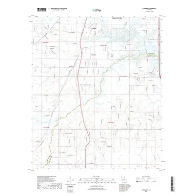
2018 Map of Stonewall
USGS Topo · Published 2018About this map
Stonewall and Keithville anchor this 2018 survey of the north Louisiana landscape where the Caddo Parish and De Soto Parish border meets. The terrain is defined by a dense network of waterways including Cypress Bayou, Buchanan Bayou, and Brush Bayou, which drain the low-lying areas between small settlements. This modern topography reveals the persistence of rural infrastructure, from the Powell Cemetery near the center of the sheet to private aviation facilities like Old Hickory Ranch Airport and Bluebird Hill Airport. The map documents the residential expansion along roads such as Mansfield Rd and Linwood Ave, illustrating how contemporary development follows the historical transit corridors south of Shreveport. Small hamlets like Staples remain distinct points in a landscape increasingly characterized by suburban road networks and established parish boundaries.
Find a feature on this map
131 named features on this map. Tap any name to fly to it.
Don’t see what you’re looking for? This feature index may not catch every label — zoom into the map to look around manually.
Map Details
Editions of this 2018 Stonewall Map
This is the sole edition of this map. No revisions or reprints were ever made.
Other maps of this area

1941 · Forbing
USGS Topo · 1:31,680

1945 · Grand Cane
USGS Topo · 1:62,500

1945 · Greenwood
USGS Topo · 1:62,500

1945 · Mansfield
USGS Topo · 1:62,500

1947 · Mansfield
USGS Topo · 1:62,500

1948 · Caspiana
USGS Topo · 1:62,500

1955 · Shreveport
USGS Topo · 1:250,000

1955 · Shreveport East
USGS Topo · 1:24,000

1955 · Caspiana
USGS Topo · 1:62,500
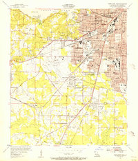
1955 · Shreveport West
USGS Topo · 1:24,000