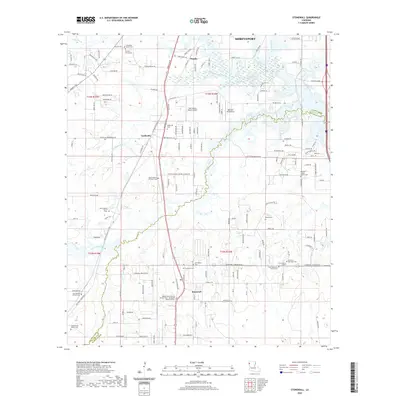
2020 Map of Stonewall
USGS Topo · Published 2020About this map
The boundary between Caddo Parish and De Soto Parish bisects this landscape, marking a transition between the southern reaches of Shreveport and the residential settlements of Keithville and Stonewall. The terrain is defined by the winding paths of Cypress Bayou and Buchanan Bayou, which create a complex system of wetlands and drainage throughout the region.
Find a feature on this map
147 named features on this map. Tap any name to fly to it.
Don’t see what you’re looking for? This feature index may not catch every label — zoom into the map to look around manually.
Map Details
Editions of this 2020 Stonewall Map
This is the sole edition of this map. No revisions or reprints were ever made.
Other maps of this area

1941 · Forbing
USGS Topo · 1:31,680

1945 · Grand Cane
USGS Topo · 1:62,500

1945 · Greenwood
USGS Topo · 1:62,500

1945 · Mansfield
USGS Topo · 1:62,500

1947 · Mansfield
USGS Topo · 1:62,500

1948 · Caspiana
USGS Topo · 1:62,500

1955 · Shreveport
USGS Topo · 1:250,000

1955 · Shreveport East
USGS Topo · 1:24,000

1955 · Caspiana
USGS Topo · 1:62,500
1955 · Shreveport West
USGS Topo · 1:24,000