Loading...
Loading map...2024 Map of Stonewall
USGS Topo · Published 2024About this map
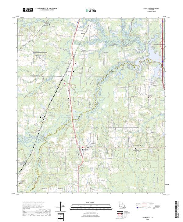
The borderlands of Caddo and De Soto parishes are defined here by a network of bayous and rural settlements centered on the Stonewall and Keithville communities. Modern road systems like Mansfield Rd and Kingston Rd cut through a landscape shaped by drainage basins including Boggy Bayou, Buchanan Bayou, and Cypress Bayou. This area preserves a significant concentration of local heritage sites, particularly in its dense collection of burial grounds and rural congregations.
Find a feature on this map
156 named features on this map. Tap any name to fly to it.
Don’t see what you’re looking for? This feature index may not catch every label — zoom into the map to look around manually.
Map Details
Date Portrayed2024
Date Published2024
PublisherU.S. Geological Survey
Map TypeTopographic
Scale1:24000
Physical Dimensions24 x 29 inches
Editions of this 2024 Stonewall Map
This is the sole edition of this map. No revisions or reprints were ever made.
Historical Maps of Shreveport Through Time
Featured Locations
Source Details
SourceU.S. Geological Survey
CopyrightPublic Domain