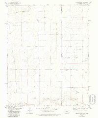
1978 Map of Stonington SE
USGS Topo · Published 1986About this map
North Fork Cimarron River winds through the southern reaches of this landscape, marking a critical water source in the high plains borderlands of the 1970s. The map illustrates a transitional environment where the state boundary of Colorado and Kansas meets the county line of Baca and Morton. This area is defined by its energy development, with numerous Oil Wells and Gas Wells dotting the sections north of the river. The small settlement area of Westola sits on the Kansas side of the line, providing a focal point for the rural road network that services these remote operations. To the north, the dry bed of Sand Arroyo cuts across the terrain, highlighting the arid character of this ranching and mineral-rich region during a period of steady industrial expansion.
Find a feature on this map
8 named features on this map. Tap any name to fly to it.
Don’t see what you’re looking for? This feature index may not catch every label — zoom into the map to look around manually.
Map Details
Editions of this 1978 Stonington SE Map
2 editions found
Other maps of this area

1892 · Vilas
USGS Topo · 1:125,000

1955 · La Junta
USGS Topo · 1:250,000

1955 · Dodge City
USGS Topo · 1:250,000

1958 · La Junta
USGS Topo · 1:250,000

1958 · Dodge City
USGS Topo · 1:250,000

1959 · Dodge City
USGS Topo · 1:250,000

1968 · La Junta
USGS Topo · 1:250,000

1973 · Richfield NW
USGS Topo · 1:24,000
1973 · Richfield SW
USGS Topo · 1:24,000
1973 · Elkhart NW
USGS Topo · 1:24,000