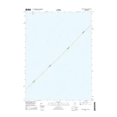
2014 Map of Stony Point OE S
USGS Topo · Published 2014About this map
Lake Erie dominates this nautical landscape, capturing the open water and political boundaries where Michigan and Ohio meet. The shoreline in the upper-left corner reveals La Plaisance Bay and the small landform of Smiths Island, providing a focused look at the coastal geography of the Monroe area. This 2014 survey is primarily a study of the state line and maritime borders, showing the precise demarcation of the Michigan-Ohio boundary as it cuts across the lake and the division between Monroe County and Lucas County. The map is essential for understanding the modern legal and environmental alignment of the western basin of the Great Lakes.
Find a feature on this map
5 named features on this map. Tap any name to fly to it.
Don’t see what you’re looking for? This feature index may not catch every label — zoom into the map to look around manually.
Map Details
Editions of this 2014 Stony Point OE S Map
This is the sole edition of this map. No revisions or reprints were ever made.
Other maps of this area

1900 · Maumee Bay
USGS Topo · 1:62,500

1900 · Oak Harbor
USGS Topo · 1:62,500

1912 · Monroe
USGS Topo · 1:62,500

1914 · Monroe
USGS Topo · 1:62,500

1927 · Monroe
USGS Topo · 1:31,680

1934 · Reno Beach
USGS Topo · 1:24,000

1934 · Point Place
USGS Topo · 1:24,000

1936 · Stony Point
USGS Topo · 1:31,680
1936 · Erie
USGS Topo · 1:31,680
1938 · Reno Beach
USGS Topo · 1:31,680