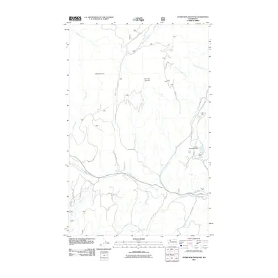
2011 Map of Storm King Mountain
USGS Topo · Published 2011About this map
Okanogan National Forest and Colville National Forest meet in this high-elevation landscape, where the terrain is dominated by the peaks of Storm King Mountain and Maple Mountain. The map reveals a legacy of resource extraction concentrated in the eastern portion, where Tom Thumb Mine, Knob Hill Mine, and Flag Hill Mine are clustered near the headwaters of regional drainages. The presence of the Day Mine Tailings Pond Dam near Mud Lake underscores the industrial footprint on the local hydrology. A complex network of Forest Service roads, including Storm King Rd and Sheridan Rd, provides access across the rugged topography. Water flows away from these heights via numerous branches of Granite Creek and Cougar Creek, illustrating the watershed's importance to the surrounding valley systems during the early 21st century.
Find a feature on this map
37 named features on this map. Tap any name to fly to it.
Don’t see what you’re looking for? This feature index may not catch every label — zoom into the map to look around manually.
Map Details
Editions of this 2011 Storm King Mountain Map
This is the sole edition of this map. No revisions or reprints were ever made.
Other maps of this area

1904 · Republic
USGS Topo · 1:125,000

1948 · Curlew
USGS Topo · 1:62,500

1948 · Republic
USGS Topo · 1:62,500

1951 · Wauconda
USGS Topo · 1:62,500

1951 · Curlew
USGS Topo · 1:62,500

1951 · Bodie Mountain
USGS Topo · 1:62,500

1951 · Republic
USGS Topo · 1:62,500

1954 · Okanogan
USGS Topo · 1:250,000

1958 · Okanogan
USGS Topo · 1:250,000

1958 · Aeneas
USGS Topo · 1:62,500