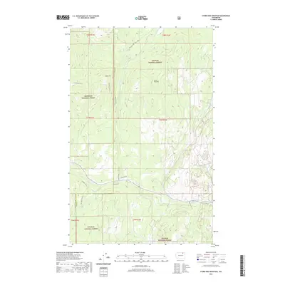
2020 Map of Storm King Mountain
USGS Topo · Published 2020About this map
Storm King Mtn and Maple Mtn dominate this high-elevation landscape along the border of Colville National Forest and Okanogan National Forest. The geography is defined by a dense network of watercourses including W Fork Trout Cr, S Fork Trout Cr, and the extensive Granite Creek drainage system. Small water bodies like Mud Lake and the Copper Lakes are tucked into the mountain folds, while the boundary between Okanogan and Ferry counties runs north-to-south through the center of the survey area. Human presence is marked by isolated forest access routes such as Gardner Crk Rd, E Lilly Creek Rd, and Timberland Dr, illustrating a region primarily managed for timber and conservation rather than dense settlement.
Find a feature on this map
26 named features on this map. Tap any name to fly to it.
Don’t see what you’re looking for? This feature index may not catch every label — zoom into the map to look around manually.
Map Details
Editions of this 2020 Storm King Mountain Map
This is the sole edition of this map. No revisions or reprints were ever made.
Other maps of this area

1904 · Republic
USGS Topo · 1:125,000

1948 · Curlew
USGS Topo · 1:62,500

1948 · Republic
USGS Topo · 1:62,500

1951 · Wauconda
USGS Topo · 1:62,500

1951 · Curlew
USGS Topo · 1:62,500

1951 · Bodie Mountain
USGS Topo · 1:62,500

1951 · Republic
USGS Topo · 1:62,500

1954 · Okanogan
USGS Topo · 1:250,000

1958 · Okanogan
USGS Topo · 1:250,000

1958 · Aeneas
USGS Topo · 1:62,500