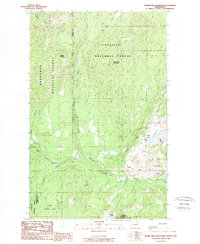
1988 Map of Storm King Mountain
USGS Topo · Published 1988About this map
Mining activity and high-elevation terrain define this late 1980s provisional survey on the Okanogan Co Ferry Co border. The landscape is dominated by the Colville National Forest and Okanogan National Forest, where steep ridgelines lead to Storm King Mountain and Maple Mountain. This edition captures a specialized industrial landscape concentrated in the southeast, where numerous resource extraction sites are clustered.
Find a feature on this map
26 named features on this map. Tap any name to fly to it.
Don’t see what you’re looking for? This feature index may not catch every label — zoom into the map to look around manually.
Map Details
Editions of this 1988 Storm King Mountain Map
This is the sole edition of this map. No revisions or reprints were ever made.
Other maps of this area

1904 · Republic
USGS Topo · 1:125,000

1948 · Curlew
USGS Topo · 1:62,500

1948 · Republic
USGS Topo · 1:62,500

1951 · Wauconda
USGS Topo · 1:62,500

1951 · Curlew
USGS Topo · 1:62,500

1951 · Bodie Mountain
USGS Topo · 1:62,500

1951 · Republic
USGS Topo · 1:62,500

1954 · Okanogan
USGS Topo · 1:250,000

1958 · Okanogan
USGS Topo · 1:250,000

1958 · Aeneas
USGS Topo · 1:62,500