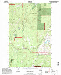
1992 Map of Storm King Mountain
USGS Topo · Published 1997About this map
Storm King Mountain and Maple Mountain anchor this high-elevation terrain along the border of Ferry County and Okanogan County. The landscape is dominated by the sprawling reaches of the Colville National Forest and Okanogan National Forest. A distinct history of resource extraction is visible through the concentration of extractive sites like the Tom Thumb Mine, Flagstaff Mine, and numerous Prospect and Mineshaft labels scattered near Knob Hill. Navigation through this rugged geography is marked by the Ninth Standard Parallel North and the Maple Mountain Trail Approximate Location. While much of the land remains wilderness, signs of recreation and infrastructure appear in the form of a Golf Course and the waters of Copper Lakes and Mud Lake.
Find a feature on this map
27 named features on this map. Tap any name to fly to it.
Don’t see what you’re looking for? This feature index may not catch every label — zoom into the map to look around manually.
Map Details
Editions of this 1992 Storm King Mountain Map
This is the sole edition of this map. No revisions or reprints were ever made.
Other maps of this area

1904 · Republic
USGS Topo · 1:125,000

1948 · Curlew
USGS Topo · 1:62,500

1948 · Republic
USGS Topo · 1:62,500

1951 · Wauconda
USGS Topo · 1:62,500

1951 · Curlew
USGS Topo · 1:62,500

1951 · Bodie Mountain
USGS Topo · 1:62,500

1951 · Republic
USGS Topo · 1:62,500

1954 · Okanogan
USGS Topo · 1:250,000

1958 · Okanogan
USGS Topo · 1:250,000

1958 · Aeneas
USGS Topo · 1:62,500