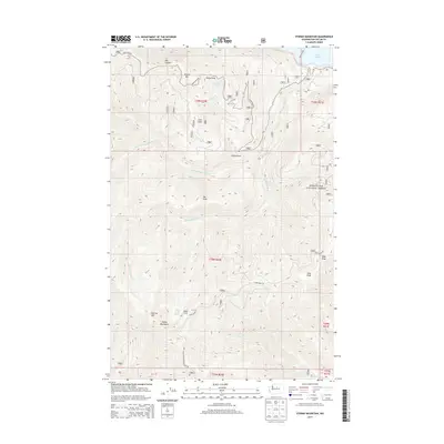
2014 Map of Stormy Mountain
USGS Topo · Published 2014About this map
The Chelan Mountains dominate this high-elevation terrain within the Wenatchee National Forest, where steep ridgelines and deep drainage basins define the geography. Centered on the towering summit of Stormy Mtn, the landscape is carved by seasonal water sources such as First Cr and Twentyfive Mile Cr. These waterways descend from high points like Pot Peak and Lone Peak toward the northern edge of the map, where a small portion of Lake Chelan becomes visible near the ferry crossing.
Find a feature on this map
28 named features on this map. Tap any name to fly to it.
Don’t see what you’re looking for? This feature index may not catch every label — zoom into the map to look around manually.
Map Details
Editions of this 2014 Stormy Mountain Map
This is the sole edition of this map. No revisions or reprints were ever made.
Other maps of this area

1899 · Methow
USGS Topo · 1:125,000

1901 · Chelan
USGS Topo · 1:125,000

1901 · Methow
USGS Topo · 1:125,000

1955 · Concrete
USGS Topo · 1:250,000

1957 · Wenatchee
USGS Topo · 1:250,000

1958 · Concrete
USGS Topo · 1:250,000

1962 · Concrete
USGS Topo · 1:250,000

1968 · South Navarre Peak
USGS Topo · 1:24,000
1968 · Big Goat Mtn
USGS Topo · 1:24,000

1968 · Tyee Mtn.
USGS Topo · 1:24,000