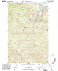
2004 Map of Stormy Mountain
USGS Topo · Published 2008About this map
The Chelan Entiat Mountains dominate this high-elevation terrain within the Wenatchee National Forest. This 2004 revision, based on earlier topographic data, illustrates the high peaks and deep drainages that define the area southwest of Lake Chelan. Notable summits such as Stormy Mountain, Pot Peak, and Lone Peak reach elevations well above 6,000 feet, connected by a network of forest roads and a Ranger District administrative presence.
Find a feature on this map
46 named features on this map. Tap any name to fly to it.
Don’t see what you’re looking for? This feature index may not catch every label — zoom into the map to look around manually.
Map Details
Editions of this 2004 Stormy Mountain Map
This is the sole edition of this map. No revisions or reprints were ever made.
Other maps of this area

1899 · Methow
USGS Topo · 1:125,000

1901 · Chelan
USGS Topo · 1:125,000

1901 · Methow
USGS Topo · 1:125,000

1955 · Concrete
USGS Topo · 1:250,000

1957 · Wenatchee
USGS Topo · 1:250,000

1958 · Concrete
USGS Topo · 1:250,000

1962 · Concrete
USGS Topo · 1:250,000

1968 · South Navarre Peak
USGS Topo · 1:24,000
1968 · Big Goat Mtn
USGS Topo · 1:24,000

1968 · Tyee Mtn.
USGS Topo · 1:24,000