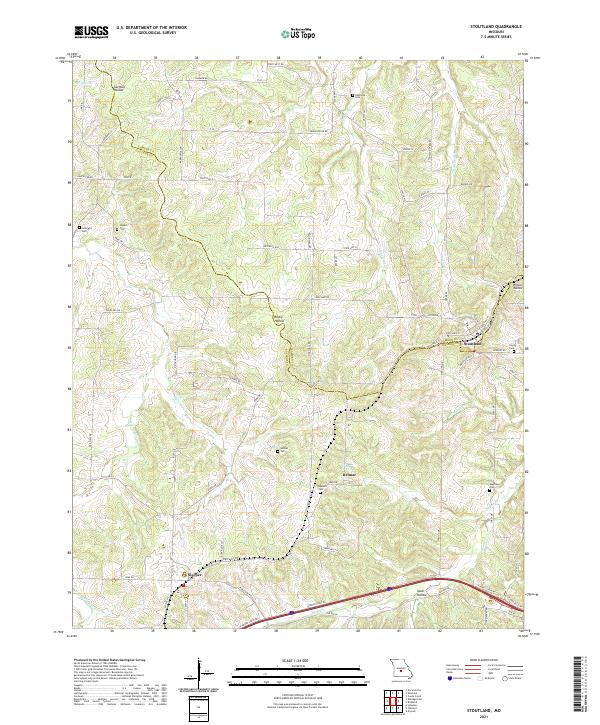
2021 Map of Stoutland
USGS Topo · Published 2021About this map
Stoutland sits at the intersection of Camden and Laclede counties, serving as a focal point for this rural Missouri landscape. The terrain is defined by its drainages, including the Dry Auglaize Cr and Stoutland Cr, which carve through various hollows such as Garman Hollow and Rocky Hollow. Settlement patterns here are tied to the local road network, with smaller communities like Sleeper and Delmar situated along primary routes.
Find a feature on this map
81 named features on this map. Tap any name to fly to it.
Don’t see what you’re looking for? This feature index may not catch every label — zoom into the map to look around manually.
Map Details
Editions of this 2021 Stoutland Map
This is the sole edition of this map. No revisions or reprints were ever made.
Other maps of this area

1933 · Stoutland
USGS Topo · 1:62,500

1938 · Stoutland
USGS Topo · 1:62,500

1941 · Lebanon
USGS Topo · 1:62,500

1943 · Richland
USGS Topo · 1:62,500

1943 · Lebanon
USGS Topo · 1:62,500

1943 · Drynob
USGS Topo · 1:62,500

1954 · Springfield
USGS Topo · 1:250,000

1954 · Drynob
USGS Topo · 1:62,500
1954 · Richland
USGS Topo · 1:62,500
1954 · Richland
USGS Topo · 1:24,000