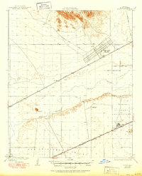
1930 Map of Stoval
USGS Topo · Published 1950About this map
The Gila River meanders through this arid landscape, flanked by the Palomas Mountains to the north and the wide San Cristobal Valley to the south. This era is defined by the critical transition from old wagon routes like the Palomas Yuma Road and Old Road to the modernizing influence of the Southern Pacific railroad. Small rail-side outposts such as Kofa Sta, Dateland, and Stoval serve as the primary human anchors in a region increasingly shaped by federal activity.
Find a feature on this map
22 named features on this map. Tap any name to fly to it.
Don’t see what you’re looking for? This feature index may not catch every label — zoom into the map to look around manually.
Map Details
Editions of this 1930 Stoval Map
4 editions found
Other maps of this area

1926 · Mohawk
USGS Topo · 1:62,500

1927 · Aguila Mountains
USGS Topo · 1:48,000

1927 · Kim
USGS Topo · 1:62,500

1927 · Hyder
USGS Topo · 1:62,500

1928 · Mohawk
USGS Topo · 1:62,500

1928 · Norton
USGS Topo · 1:62,500

1929 · Aztec
USGS Topo · 1:62,500

1929 · Norton
USGS Topo · 1:62,500

1930 · Aguila Mountains
USGS Topo · 1:62,500

1930 · Stoval
USGS Topo · 1:62,500