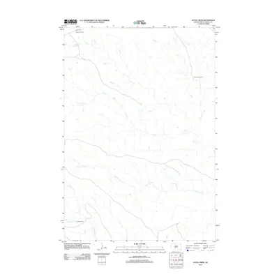
2012 Map of Stove Creek
USGS Topo · Published 2012About this map
Oscar Gray Ranch and other family holdings define the remote cattle-ranching landscape of Dewey County in this 2012 survey. The terrain is structured by a series of intermittent drainage systems, notably Stove Cr and Scatter Butte Cr, which carve shallow paths through the open plains. These watercourses were essential to the development of early 21st-century ranching operations in this part of South Dakota. The map captures the spatial distribution of these rural homesteads, including the Delaine Gray Ranch and Dan Gray Ranch, connected by localized infrastructure like Co Hwy 14G. This record provides genealogists and land historians with a clear view of familial land use patterns and the sparse transportation network, including U.S. Route 212, that serviced the region at the start of the decade.
Find a feature on this map
8 named features on this map. Tap any name to fly to it.
Don’t see what you’re looking for? This feature index may not catch every label — zoom into the map to look around manually.
Map Details
Editions of this 2012 Stove Creek Map
This is the sole edition of this map. No revisions or reprints were ever made.
Other maps of this area

1951 · Virginia
USGS Topo · 1:24,000

1951 · La Plant
USGS Topo · 1:24,000

1953 · McIntosh
USGS Topo · 1:250,000

1954 · Pierre
USGS Topo · 1:250,000

1958 · Pierre
USGS Topo · 1:250,000

1958 · McIntosh
USGS Topo · 1:250,000

1969 · Artichoke Butte NW
USGS Topo · 1:24,000

1969 · Patch Skin Buttes SW
USGS Topo · 1:24,000

1970 · Patch Skin Buttes
USGS Topo · 1:24,000
1981 · No Heart Creek NE
USGS Topo · 1:24,000