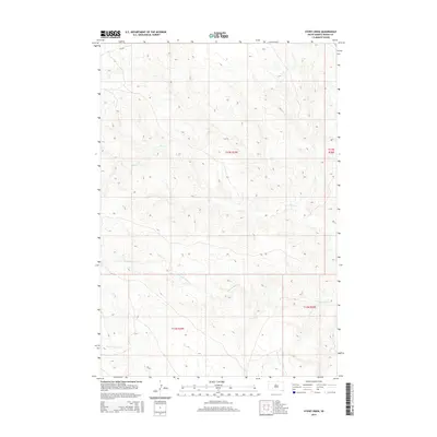
2015 Map of Stove Creek
USGS Topo · Published 2015About this map
Stove Cr meanders eastward through the heart of this Dewey County landscape, defining the drainage patterns of this central South Dakota region. The map reveals a remote, open terrain where the elevation gradually descends toward the river breaks, shaped by seasonal watercourses like Scatter Butte Cr and the E Br Willow Cr. These drainage systems are central to the local topography, influencing the placement of section lines and rural access roads across the townships of T12N and T13N. Without major settlements or towns, the map serves as a detailed record of the natural hydrology and land divisions that govern this part of the state, providing an essential resource for those studying the physical geography or land-use history of the area.
Find a feature on this map
7 named features on this map. Tap any name to fly to it.
Don’t see what you’re looking for? This feature index may not catch every label — zoom into the map to look around manually.
Map Details
Editions of this 2015 Stove Creek Map
This is the sole edition of this map. No revisions or reprints were ever made.
Other maps of this area

1951 · Virginia
USGS Topo · 1:24,000

1951 · La Plant
USGS Topo · 1:24,000

1953 · McIntosh
USGS Topo · 1:250,000

1954 · Pierre
USGS Topo · 1:250,000

1958 · Pierre
USGS Topo · 1:250,000

1958 · McIntosh
USGS Topo · 1:250,000

1969 · Artichoke Butte NW
USGS Topo · 1:24,000

1969 · Patch Skin Buttes SW
USGS Topo · 1:24,000

1970 · Patch Skin Buttes
USGS Topo · 1:24,000
1981 · No Heart Creek NE
USGS Topo · 1:24,000