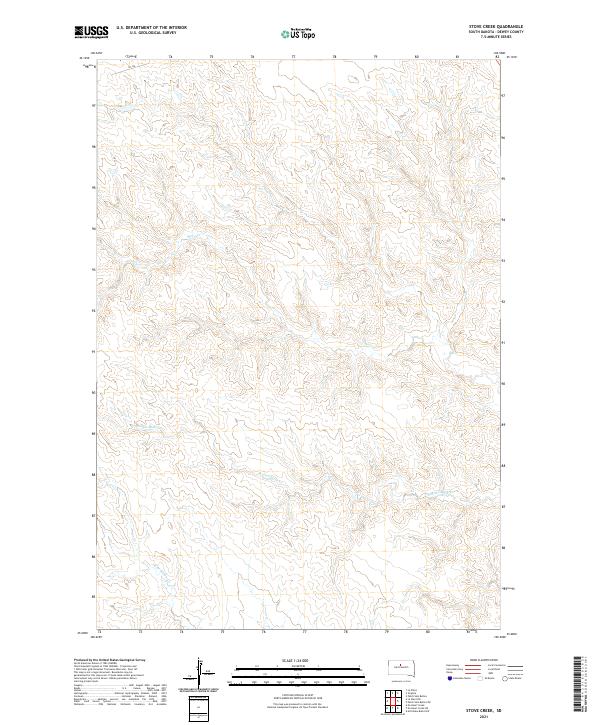
2021 Map of Stove Creek
USGS Topo · Published 2021About this map
Stove Cr and its many unnamed tributaries carve a complex drainage pattern across this section of Dewey County, where the elevation ranges from under 1,700 to over 2,100 feet. The landscape is defined by the stark separation between upland plateaus and the deeply eroded coulees of the Scatter Butte Cr and E Br Willow Cr watersheds. This 2021 topographic record reveals a sparsely developed region of South Dakota, where human imprint is limited to a few section-line tracks and the primary thoroughfare of CR 14g. The Public Land Survey System grid, including townships t13n r29e and t12n r29e, provides the primary structure for navigating this expansive prairie terrain.
Find a feature on this map
8 named features on this map. Tap any name to fly to it.
Don’t see what you’re looking for? This feature index may not catch every label — zoom into the map to look around manually.
Map Details
Editions of this 2021 Stove Creek Map
This is the sole edition of this map. No revisions or reprints were ever made.
Other maps of this area

1951 · Virginia
USGS Topo · 1:24,000

1951 · La Plant
USGS Topo · 1:24,000

1953 · McIntosh
USGS Topo · 1:250,000

1954 · Pierre
USGS Topo · 1:250,000

1958 · Pierre
USGS Topo · 1:250,000

1958 · McIntosh
USGS Topo · 1:250,000

1969 · Artichoke Butte NW
USGS Topo · 1:24,000

1969 · Patch Skin Buttes SW
USGS Topo · 1:24,000

1970 · Patch Skin Buttes
USGS Topo · 1:24,000
1981 · No Heart Creek NE
USGS Topo · 1:24,000