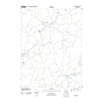
2010 Map of Stoystown
USGS Topo · Published 2010About this map
The Stonycreek River carves a winding path through this corner of Somerset County, anchoring a landscape defined by small hamlets and the development of water resources. In the north, Stoystown and Kantner sit near the river's upper reaches, while to the south, Shanksville occupies a prominent position where the Stonycreek River meets Rhoads Creek. This area shows a transition from traditional agricultural and milling sites, like Walkers Mill and the nearby Walker Cemetery, to more modern recreational and utility landmarks. The eastern portion of the sheet is dominated by significant water features including Lake Stonycreek, controlled by the Lake Stonycreek Dam, and the neighboring Indian Lake. Smaller named settlements such as Mostoller, Kimmelton, and Lambertsville are connected by a network of rural routes like Old Lincoln Hwy and Old Forbes Rd, tracing historical paths through the Glades Valley and across Walnut Hill.
Find a feature on this map
98 named features on this map. Tap any name to fly to it.
Don’t see what you’re looking for? This feature index may not catch every label — zoom into the map to look around manually.
Map Details
Editions of this 2010 Stoystown Map
This is the sole edition of this map. No revisions or reprints were ever made.
Other maps of this area

1913 · Somerset
USGS Topo · 1:62,500

1914 · Windber
USGS Topo · 1:62,500

1915 · Somerset
USGS Topo · 1:62,500

1916 · Windber
USGS Topo · 1:62,500

1921 · Meyersdale
USGS Topo · 1:62,500

1923 · Berlin
USGS Topo · 1:48,000

1929 · Berlin
USGS Topo · 1:62,500

1939 · Meyersdale
USGS Topo · 1:62,500

1944 · Somerset
USGS Topo · 1:62,500

1944 · Windber
USGS Topo · 1:62,500