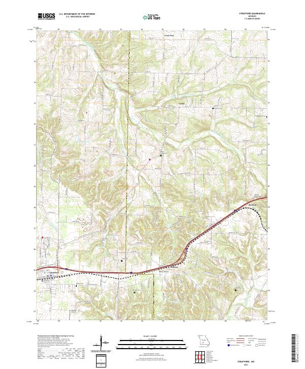
2021 Map of Strafford
USGS Topo · Published 2021About this map
The Pomme de Terre River and its various forks dominate the northern landscape of this Missouri Ozarks corridor, where the Greene Co Webster Co boundary line bisects rural townships. Small settlements like Caddo, Holman, and Cross Way anchor a network of county roads and farm-to-market routes that trace the undulating terrain of Millan Hollow and the surrounding heights. In the southwest corner, Strafford serves as a modern hub along the interstate corridor, yet the map maintains a clear record of older local identifiers, from Cuinche Airport to the scattered family burial grounds that reflect generations of local residency. Notable water features such as Mueller Lake and Salisbury Lake dot the central plains, while the James River and Little Sac River mark the edges of these separate drainage basins.
Find a feature on this map
118 named features on this map. Tap any name to fly to it.
Don’t see what you’re looking for? This feature index may not catch every label — zoom into the map to look around manually.
Map Details
Editions of this 2021 Strafford Map
This is the sole edition of this map. No revisions or reprints were ever made.
Other maps of this area

1884 · Springfield
USGS Topo · 1:125,000

1886 · Springfield
USGS Topo · 1:125,000

1937 · Galloway
USGS Topo · 1:24,000

1937 · Ozark
USGS Topo · 1:48,000

1939 · Fordland
USGS Topo · 1:62,500

1942 · Fordland
USGS Topo · 1:62,500

1943 · Ozark
USGS Topo · 1:62,500

1945 · Ozark
USGS Topo · 1:62,500

1946 · Bassville
USGS Topo · 1:24,000

1946 · Niangua
USGS Topo · 1:62,500