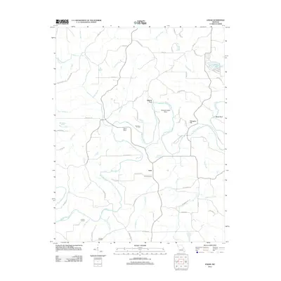
2012 Map of Strain
USGS Topo · Published 2012About this map
The Bourbeuse River winds through this rural landscape in Franklin County, defining the local geography with its sharp meanders and crossings. Small settlements like Champion City and Strain serve as focal points for a network of country roads, where family history is anchored by sites such as Schmidt Cemetery and McCallister Cemetery. The terrain is shaped by the river's influence, seen in the naming of river landmarks like Kampschroeder Bend, Bartel Bend, and historic crossing points including Millrock Ford and Rock Ford. To the south, the Little Bourbeuse River and Logan Branch contribute to the drainage system of this agricultural area. Local recreation and water management are reflected in Melody Lake and W J Slais Lake, while the presence of the Old Japan Cemetery near the southern boundary hints at the deeper settlement history and vanished communities of this Missouri interior.
Find a feature on this map
69 named features on this map. Tap any name to fly to it.
Don’t see what you’re looking for? This feature index may not catch every label — zoom into the map to look around manually.
Map Details
Editions of this 2012 Strain Map
This is the sole edition of this map. No revisions or reprints were ever made.
Other maps of this area

1903 · Sullivan
USGS Topo · 1:125,000

1935 · Gerald
USGS Topo · 1:48,000

1941 · Gerald
USGS Topo · 1:62,500

1944 · Gerald
USGS Topo · 1:62,500

1946 · Union
USGS Topo · 1:62,500

1947 · Sullivan
USGS Topo · 1:62,500

1948 · Argo
USGS Topo · 1:24,000

1948 · Union
USGS Topo · 1:62,500

1948 · Oak Hill
USGS Topo · 1:24,000

1949 · Saint Louis
USGS Topo · 1:250,000