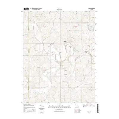
2015 Map of Strain
USGS Topo · Published 2015About this map
The Bourbeuse River snakes through the center of this rural landscape, carving distinct features like Bartel Bend and Kampschroeder Bend as it flows toward Champion City. This 2015 survey reveals a terrain defined by its water and winding roads, where small family-named water bodies like Oscar Fuergons Lake and Alvina Koelling Lake dot the countryside. The presence of multiple historic burial sites, including McCallister Cemetery and Schmidt Cemetery, provides significant data for genealogists tracking local families near the community of Strain.
Find a feature on this map
91 named features on this map. Tap any name to fly to it.
Don’t see what you’re looking for? This feature index may not catch every label — zoom into the map to look around manually.
Map Details
Editions of this 2015 Strain Map
This is the sole edition of this map. No revisions or reprints were ever made.
Other maps of this area

1903 · Sullivan
USGS Topo · 1:125,000

1935 · Gerald
USGS Topo · 1:48,000

1941 · Gerald
USGS Topo · 1:62,500

1944 · Gerald
USGS Topo · 1:62,500

1946 · Union
USGS Topo · 1:62,500

1947 · Sullivan
USGS Topo · 1:62,500

1948 · Argo
USGS Topo · 1:24,000

1948 · Union
USGS Topo · 1:62,500

1948 · Oak Hill
USGS Topo · 1:24,000

1949 · Saint Louis
USGS Topo · 1:250,000