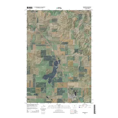
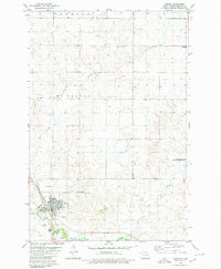
2014 Map of Strasburg
USGS Topo · Published 2014About this map
Strasburg serves as the primary hub of this Emmons County landscape, situated at the intersection of a grid-iron street plan and the regional highway system. The town's layout is centered on Main St, with the Reform Cem positioned on the eastern outskirts, providing a clear reference for local genealogy and history. To the north and west, the terrain is defined by the significant expanse of Baumgartner Lake and the winding course of Beaver Cr, which dictate the rural road patterns that follow section lines like 87th St SE. The presence of the Linton Municipal Airport in the northwest corner highlights the area's modern infrastructure. This 2014 survey documents a classic North Dakota prairie community, where the relationship between the built environment of Strasburg and the surrounding natural water features remains the defining characteristic of the region.
Find a feature on this map
28 named features on this map. Tap any name to fly to it.
Don’t see what you’re looking for? This feature index may not catch every label — zoom into the map to look around manually.
Map Details
Editions of this 2014 Strasburg Map
This is the sole edition of this map. No revisions or reprints were ever made.
Other maps of this area

1954 · Bismarck
USGS Topo · 1:250,000

1958 · Bismarck
USGS Topo · 1:250,000
1971 · Grassna
USGS Topo · 1:24,000

1971 · Grassna NE
USGS Topo · 1:24,000

1971 · Strasburg
USGS Topo · 1:24,000

1971 · Temvik
USGS Topo · 1:24,000

1979 · Senger Lake North
USGS Topo · 1:24,000
1979 · Westfield
USGS Topo · 1:24,000
1979 · Senger Lake South
USGS Topo · 1:24,000
1980 · Linton
USGS Topo · 1:24,000