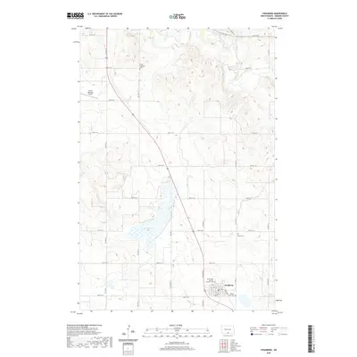
2020 Map of Strasburg
USGS Topo · Published 2020About this map
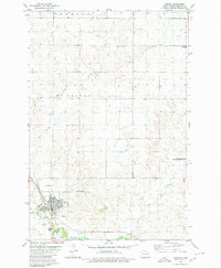
Strasburg serves as the primary hub in this portion of Emmons County, characterized by a grid of residential streets like N 2nd St and S 3rd St. The surrounding landscape is defined by the drainage of Beaver Cr and the waters of Baumgartner Lake, which interrupt the regular section lines of the rural road network. For those tracing family history, the area contains several dedicated burial grounds, including the Peace Lutheran Cem to the north and the Saints Peter and Paul Catholic Cem within the town itself. The proximity of the Linton Municipal Airport on the western edge of the map indicates the region's connection to wider transportation networks. Local transit is facilitated by named thoroughfares such as Rodeo Rd and Bosch Ln, providing access to the expansive agricultural tracts that dominate the terrain.
Find a feature on this map
31 named features on this map. Tap any name to fly to it.
Don’t see what you’re looking for? This feature index may not catch every label — zoom into the map to look around manually.
Map Details
Editions of this 2020 Strasburg Map
This is the sole edition of this map. No revisions or reprints were ever made.
Other maps of this area

1954 · Bismarck
USGS Topo · 1:250,000

1958 · Bismarck
USGS Topo · 1:250,000
1971 · Grassna
USGS Topo · 1:24,000

1971 · Grassna NE
USGS Topo · 1:24,000

1971 · Strasburg
USGS Topo · 1:24,000

1971 · Temvik
USGS Topo · 1:24,000

1979 · Senger Lake North
USGS Topo · 1:24,000
1979 · Westfield
USGS Topo · 1:24,000
1979 · Senger Lake South
USGS Topo · 1:24,000
1980 · Linton
USGS Topo · 1:24,000