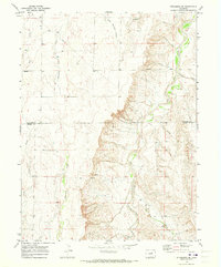
1969 Map of Strasburg SE
USGS Topo · Published 1978About this map
The boundary between Arapahoe and Elbert counties cuts through this high plains landscape, where water drainage patterns dictate the placement of ranching infrastructure and early industry. Surveyed in the late 1960s, the map reveals a network of intermittent streams and gulches that feed into larger arteries like West Bijou Creek and Comanche Creek. A notable Pipeline corridor traverses the northern and eastern sections, reflecting the region's energy infrastructure development during this era.
Find a feature on this map
12 named features on this map. Tap any name to fly to it.
Don’t see what you’re looking for? This feature index may not catch every label — zoom into the map to look around manually.
Map Details
Editions of this 1969 Strasburg SE Map
2 editions found
Other maps of this area

1953 · Denver
USGS Topo · 1:250,000

1955 · Strasburg NW
USGS Topo · 1:24,000

1955 · Strasburg
USGS Topo · 1:24,000

1956 · Byers
USGS Topo · 1:24,000

1957 · Denver
USGS Topo · 1:250,000

1958 · Denver
USGS Topo · 1:250,000

1960 · Denver
USGS Topo · 1:250,000
1961 · Strasburg SW
USGS Topo · 1:24,000
1969 · Strasburg SE
USGS Topo · 1:24,000
1969 · Byers SW
USGS Topo · 1:24,000