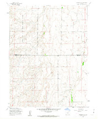
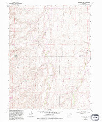
1961 Map of Strasburg SW
USGS Topo · Published 1962About this map
The Lowry Air Force Base Bombing Range dominates the western landscape of this 1961 survey, where the high plains terrain was utilized for military training. Located along the border of Arapahoe Co and Elbert Co, the map reveals a stark, functional geography defined by points such as Bomb, Fuse, and Range. This intersection of military activity and rural administration highlights an era when massive tracts of eastern Colorado were cordoned off for Cold War-era defense operations.
Find a feature on this map
9 named features on this map. Tap any name to fly to it.
Don’t see what you’re looking for? This feature index may not catch every label — zoom into the map to look around manually.
Map Details
Editions of this 1961 Strasburg SW Map
5 editions found
Other maps of this area

1890 · East Denver
USGS Topo · 1:125,000

1894 · Castle Rock
USGS Topo · 1:125,000

1913 · Castle Rock
USGS Topo · 1:125,000

1939 · Elizabeth
USGS Topo · 1:62,500

1945 · Elizabeth
USGS Topo · 1:62,500

1953 · Denver
USGS Topo · 1:250,000

1954 · Watkins
USGS Topo · 1:24,000

1955 · Strasburg NW
USGS Topo · 1:24,000

1955 · Watkins SE
USGS Topo · 1:24,000

1955 · Strasburg
USGS Topo · 1:24,000