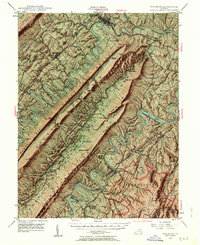
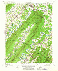
1947 Map of Strasburg
USGS Topo · Published 1964About this map
Strasburg and the dramatic ridges of Massanutten Mountain dominate this mid-century landscape, where the North Fork Shenandoah River winds in tight oxbows below Three Top Mountain. The area is a nexus of early Virginia transportation, featuring the junction of the Southern Railway and the Norfolk and Western Railway, alongside the historic Valley Pike. Local history is preserved in the placement of numerous rural congregations and resting places, such as Saint Davids Church and the Mt Olive Cem. Within the George Washington National Forest, the map reveals the complex topography of the Powell Mountain range and the remote interior of Little Fort Mountain, including the Elizabeth Furnace Recreational Area. The presence of the Otterburn Sch and Goode Mill provides evidence of the dispersed agrarian settlements that once flourished along the river forks and mountain gaps.
Find a feature on this map
128 named features on this map. Tap any name to fly to it.
Don’t see what you’re looking for? This feature index may not catch every label — zoom into the map to look around manually.
Map Details
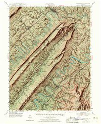
Editions of this 1947 Strasburg Map
7 editions found

Other maps of this area

1891 · Romney
USGS Topo · 1:125,000

1892 · Woodstock
USGS Topo · 1:125,000

1893 · Luray
USGS Topo · 1:125,000

1894 · Winchester
USGS Topo · 1:125,000

1905 · Luray
USGS Topo · 1:125,000

1922 · Wardensville
USGS Topo · 1:62,500

1923 · Middletown
USGS Topo · 1:62,500

1923 · Edinburg
USGS Topo · 1:62,500

1924 · Wardensville
USGS Topo · 1:62,500

1929 · Stony Man
USGS Topo · 1:48,000