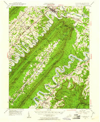
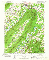
1947 Map of Strasburg
USGS Topo · Published 1961About this map
Strasburg and the winding meanders of the North Fork Shenandoah River define this post-war landscape in the Shenandoah Valley. The valley floor is tightly settled along the Valley Pike and the Southern Railway, where towns like Toms Brook, Maurertown, and Woodstock grew as commercial hubs. Rising sharply to the east, the massive ridges of Massanatten Mountain dominate the terrain, sequestering small upland communities like Seven Fountains and Detrick within the narrow valley of Passage Creek. This geography created distinct pockets of development, where riverside industry at Goods Mill contrasted with the remote forest recreation found at the Elizabeth Furnace Recreational Area. In the south, the South Fork Shenandoah River snakes past Bentonville and Rileyville, tracked by the Norfolk and Western Railway through the rugged mountain gaps.
Find a feature on this map
101 named features on this map. Tap any name to fly to it.
Don’t see what you’re looking for? This feature index may not catch every label — zoom into the map to look around manually.
Map Details
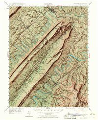
Editions of this 1947 Strasburg Map
7 editions found

Other maps of this area

1891 · Romney
USGS Topo · 1:125,000

1892 · Woodstock
USGS Topo · 1:125,000

1893 · Luray
USGS Topo · 1:125,000

1894 · Winchester
USGS Topo · 1:125,000

1905 · Luray
USGS Topo · 1:125,000

1922 · Wardensville
USGS Topo · 1:62,500

1923 · Middletown
USGS Topo · 1:62,500

1923 · Edinburg
USGS Topo · 1:62,500

1924 · Wardensville
USGS Topo · 1:62,500

1929 · Stony Man
USGS Topo · 1:48,000