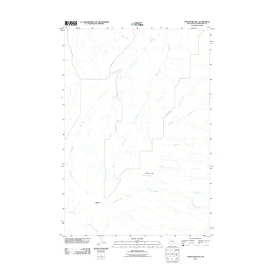
2011 Map of Stratford Hill
USGS Topo · Published 2011About this map
Stratford Hill and the surrounding Yellowstone County uplands are defined by a complex drainage system where numerous creeks carve through the Montana landscape. Watercourses such as Blue Creek, Wyman Creek, and Monument Creek dictate the local topography, creating a series of ridges and draws. These natural features provided the framework for early ranching and transport routes, as seen in the placement of Duck Creek Rd and Stratford Hill Rd. High points like McCormick Hill offer a perspective on how the land was partitioned and utilized during this period. The map reveals a transition from these primary creek beds to higher ground, showing a landscape where water access and elevation were the primary drivers for land use and the development of local roads like Cormier Rd.
Find a feature on this map
16 named features on this map. Tap any name to fly to it.
Don’t see what you’re looking for? This feature index may not catch every label — zoom into the map to look around manually.
Map Details
Editions of this 2011 Stratford Hill Map
This is the sole edition of this map. No revisions or reprints were ever made.
Other maps of this area

1893 · Huntley
USGS Topo · 1:125,000

1954 · Billings
USGS Topo · 1:250,000

1956 · Yegen
USGS Topo · 1:24,000

1956 · Mossmain
USGS Topo · 1:24,000

1957 · Billings
USGS Topo · 1:250,000

1958 · Billings
USGS Topo · 1:250,000

1967 · Deep Creek
USGS Topo · 1:24,000

1967 · Pryor
USGS Topo · 1:24,000
1967 · Mossmain SW
USGS Topo · 1:24,000

1967 · Soda Springs NW
USGS Topo · 1:24,000