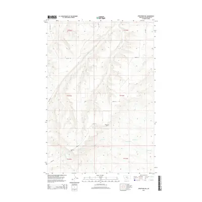
2014 Map of Stratford Hill
USGS Topo · Published 2014About this map
Stratford Hill and McCormick Hill anchor the high ground in this section of Yellowstone County, where the landscape is defined by an intricate network of drainages and seasonal watercourses. The drainage patterns are particularly dense, with Blue Cr and its various tributaries like Wyman Cr and Newman Cr carving the northern terrain, while Monument Cr and Hamilton Cr flow through the central and southern reaches.
Find a feature on this map
21 named features on this map. Tap any name to fly to it.
Don’t see what you’re looking for? This feature index may not catch every label — zoom into the map to look around manually.
Map Details
Editions of this 2014 Stratford Hill Map
This is the sole edition of this map. No revisions or reprints were ever made.
Other maps of this area

1893 · Huntley
USGS Topo · 1:125,000

1954 · Billings
USGS Topo · 1:250,000

1956 · Yegen
USGS Topo · 1:24,000

1956 · Mossmain
USGS Topo · 1:24,000

1957 · Billings
USGS Topo · 1:250,000

1958 · Billings
USGS Topo · 1:250,000

1967 · Deep Creek
USGS Topo · 1:24,000

1967 · Pryor
USGS Topo · 1:24,000
1967 · Mossmain SW
USGS Topo · 1:24,000

1967 · Soda Springs NW
USGS Topo · 1:24,000