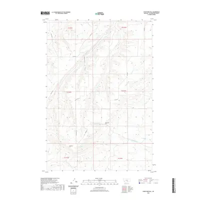
2020 Map of Stratford Hill
USGS Topo · Published 2020About this map
Stratford Hill and McCormick Hill rise as prominent landmarks in this section of Yellowstone County, shaping a landscape defined by an intricate network of drainages. The area is dissected by numerous seasonal and perennial streams, including Newman Cr, Blue Cr, and the patriotically named Fourth of July Cr. These watercourses flow through a series of north-south trending valleys, which have historically dictated the placement of local thoroughfares such as Duck Creek Rd and Hillcrest Rd. The presence of several family-named landmarks like Cormier Rd and Hamilton Cr suggests the deep-rooted agricultural and ranching heritage of this Montana upland. This 2020 survey captures the region's topography just before the modern era, showing the primary access routes like Stratford Hill Rd that connect these dispersed rural tracts.
Find a feature on this map
22 named features on this map. Tap any name to fly to it.
Don’t see what you’re looking for? This feature index may not catch every label — zoom into the map to look around manually.
Map Details
Editions of this 2020 Stratford Hill Map
This is the sole edition of this map. No revisions or reprints were ever made.
Other maps of this area

1893 · Huntley
USGS Topo · 1:125,000

1954 · Billings
USGS Topo · 1:250,000

1956 · Yegen
USGS Topo · 1:24,000

1956 · Mossmain
USGS Topo · 1:24,000

1957 · Billings
USGS Topo · 1:250,000

1958 · Billings
USGS Topo · 1:250,000

1967 · Deep Creek
USGS Topo · 1:24,000

1967 · Pryor
USGS Topo · 1:24,000
1967 · Mossmain SW
USGS Topo · 1:24,000

1967 · Soda Springs NW
USGS Topo · 1:24,000