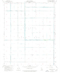
1954 Map of Stratford SE
USGS Topo · Published 1976About this map
Tulare Lake Bed dominates this portion of Kings County, showing a landscape reshaped by heavy hydrological management in the mid-1950s. The once-vast freshwater lake is here depicted as a grid of reclaimed agricultural land and levee systems, illustrating the transition from a natural basin to a controlled industrial farming environment. The Tule River and the North Central Levee define the movement of water across the flats, while the Midlake Substation stands as a lonely landmark of electrical infrastructure in the open basin. Extensive water management is further evidenced by the Lovelace Levee, Goldberg Levee, and the Cohn Levee, which protect the low-lying sections. The presence of numerous wells and the Wilbur ditch line further emphasize the intensive effort to maintain productivity in this former lake bottom.
Find a feature on this map
14 named features on this map. Tap any name to fly to it.
Don’t see what you’re looking for? This feature index may not catch every label — zoom into the map to look around manually.
Map Details
Editions of this 1954 Stratford SE Map
2 editions found
Other maps of this area

1914 · Lost Hills
USGS Topo · 1:125,000

1929 · Guernsey
USGS Topo · 1:31,680

1929 · Stratford
USGS Topo · 1:31,680

1929 · Westhaven
USGS Topo · 1:31,680

1930 · Middle Dome
USGS Topo · 1:31,680

1931 · Harvester
USGS Topo · 1:31,680

1932 · El Rico Ranch
USGS Topo · 1:31,680

1932 · Dudley Ridge
USGS Topo · 1:31,680

1933 · Kettleman City
USGS Topo · 1:31,680

1933 · Chatom Ranch
USGS Topo · 1:31,680