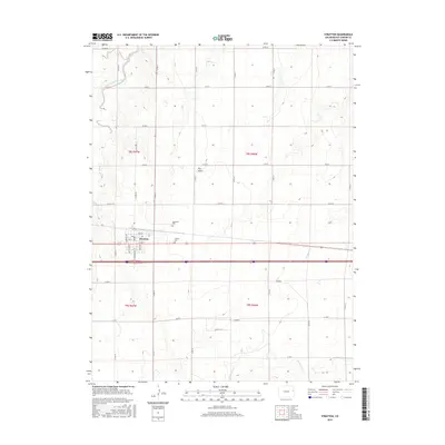
2016 Map of Stratton
USGS Topo · Published 2016About this map
The town of Stratton serves as the central hub for this High Plains landscape in Kit Carson County, defined by its rigid grid of agricultural roads and intermittent waterways. The settlement is clearly mapped with named streets including Main St, Colorado Ave, and Wyoming Ave, reflecting its role as a local center of commerce and transit. Surrounding the town site, the landscape is punctuated by the East Branch Spring Creek to the northwest and the courses of Sevenmile Creek and Landsman Creek to the south.
Find a feature on this map
30 named features on this map. Tap any name to fly to it.
Don’t see what you’re looking for? This feature index may not catch every label — zoom into the map to look around manually.
Map Details
Editions of this 2016 Stratton Map
This is the sole edition of this map. No revisions or reprints were ever made.
Other maps of this area

1954 · Limon
USGS Topo · 1:250,000

1957 · Limon
USGS Topo · 1:250,000

1958 · Limon
USGS Topo · 1:250,000

1969 · Alpine Ranch NE
USGS Topo · 1:24,000

1969 · Settlement
USGS Topo · 1:24,000

1969 · Tuttle
USGS Topo · 1:24,000

1969 · Bethune
USGS Topo · 1:24,000

1969 · Burlington 3 NW
USGS Topo · 1:24,000

1969 · Stratton
USGS Topo · 1:24,000
1970 · South of Bethune
USGS Topo · 1:24,000