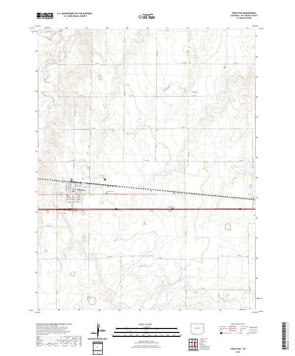
2022 Map of Stratton
USGS Topo · Published 2022About this map
Stratton serves as the primary hub of this high plains landscape, organized around a traditional grid of streets and avenues along a primary east-west transportation corridor. The town's historical foundations are marked by local burial grounds, including Clairmont Cem to the northwest and Calvary Cem situated just east of the main settlement. This 2022 survey illustrates a landscape where modern infrastructure intersects with the natural drainage patterns of the eastern Colorado plains.
Find a feature on this map
12 named features on this map. Tap any name to fly to it.
Don’t see what you’re looking for? This feature index may not catch every label — zoom into the map to look around manually.
Map Details
Editions of this 2022 Stratton Map
This is the sole edition of this map. No revisions or reprints were ever made.
Other maps of this area

1954 · Limon
USGS Topo · 1:250,000

1957 · Limon
USGS Topo · 1:250,000

1958 · Limon
USGS Topo · 1:250,000

1969 · Alpine Ranch NE
USGS Topo · 1:24,000

1969 · Settlement
USGS Topo · 1:24,000

1969 · Tuttle
USGS Topo · 1:24,000

1969 · Bethune
USGS Topo · 1:24,000

1969 · Burlington 3 NW
USGS Topo · 1:24,000

1969 · Stratton
USGS Topo · 1:24,000
1970 · South of Bethune
USGS Topo · 1:24,000