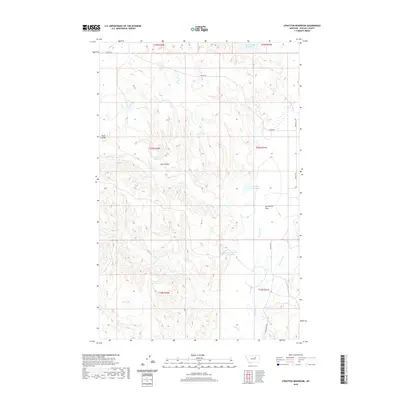
2020 Map of Stratton Reservoir
USGS Topo · Published 2020About this map
Sun Prairie Flats and a vast network of water management features dominate this landscape in Phillips County. The terrain is defined by its drainages and numerous small impoundments, including the central Stratton Reservoir and the uniquely named Number Twenty Reservoir. These features, along with King Reservoir and Skull Reservoir, indicate a landscape heavily adapted for livestock or local water storage in an otherwise arid region. Grounded in rural infrastructure, the area is connected by a few persistent routes such as Regina Rd and Sun Prairie Rd. Notable geographic markers like Tank Coulee and Dry Lake further illustrate the fluctuating hydrology of the region, where water is the primary architect of the local economy and movement.
Find a feature on this map
23 named features on this map. Tap any name to fly to it.
Don’t see what you’re looking for? This feature index may not catch every label — zoom into the map to look around manually.
Map Details
Editions of this 2020 Stratton Reservoir Map
This is the sole edition of this map. No revisions or reprints were ever made.
Other maps of this area

1954 · Jordan
USGS Topo · 1:250,000

1956 · Jordan
USGS Topo · 1:250,000

1958 · Jordan
USGS Topo · 1:250,000

1964 · Jordan
USGS Topo · 1:250,000

1965 · Sun Prairie
USGS Topo · 1:24,000

1965 · Herman Point
USGS Topo · 1:24,000

1965 · Whitcomb Lake
USGS Topo · 1:24,000
1965 · Stratton Reservoir
USGS Topo · 1:24,000
1965 · Dione Reservoir
USGS Topo · 1:24,000

1965 · Sheep Coulee
USGS Topo · 1:24,000