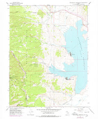
1966 Map of Strawberry Reservoir NW
USGS Topo · Published 1978About this map
Strawberry Reservoir dominates the eastern half of this landscape, its western shores carved by high-elevation drainage and complex water engineering. Significant hydrological infrastructure is visible, including the Indian Creek Diversion Canal and the subterranean water transfer system marked by the Gaging Station West Portal and East Portal. These features illustrate the mid-century management of the Strawberry Valley watershed for irrigation and regional water needs.
Find a feature on this map
30 named features on this map. Tap any name to fly to it.
Don’t see what you’re looking for? This feature index may not catch every label — zoom into the map to look around manually.
Map Details
Editions of this 1966 Strawberry Reservoir NW Map
2 editions found
Other maps of this area

1885 · Salt Lake
USGS Topo · 1:250,000

1907 · Strawberry Valley
USGS Topo · 1:125,000

1909 · Strawberry Valley
USGS Topo · 1:125,000

1954 · Salt Lake City
USGS Topo · 1:250,000

1958 · Salt Lake City
USGS Topo · 1:250,000

1960 · Salt Lake City
USGS Topo · 1:250,000

1966 · Strawberry Reservoir NW
USGS Topo · 1:24,000
1966 · Strawberry Reservoir NE
USGS Topo · 1:24,000
1966 · Strawberry Reservoir SW
USGS Topo · 1:24,000

1967 · Two Tom Hill
USGS Topo · 1:24,000