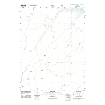
2011 Map of Strawberry Reservoir SW
USGS Topo · Published 2011About this map
Soldier Creek Reservoir anchors the northeast corner of this high-elevation terrain in Utah County, where the landscape is defined by a dense network of canyons and drainages feeding into the Strawberry Valley system. The topography is dominated by prominent landforms such as Baldy Mountain, Little Baldy Mountain, and the long spine of Partridge Ridge, which separates significant seasonal watercourses. Transportation is primarily limited to forest routes like Indian Creek Rd and US Hwy Forest Rd 131, providing access to recreation at Renegade Point Campground. The map reveals the intricate drainage patterns of Streeper Creek and Chipman Creek, highlighting a landscape managed for wilderness and watershed protection. Distinctive landmarks such as Chaplain Point and Racetrack Hollow offer precise reference points for those studying the remote geography of the Wasatch Range foothills.
Find a feature on this map
26 named features on this map. Tap any name to fly to it.
Don’t see what you’re looking for? This feature index may not catch every label — zoom into the map to look around manually.
Map Details
Editions of this 2011 Strawberry Reservoir SW Map
This is the sole edition of this map. No revisions or reprints were ever made.
Other maps of this area

1885 · Salt Lake
USGS Topo · 1:250,000

1885 · Manti
USGS Topo · 1:250,000

1895 · Manti
USGS Topo · 1:250,000

1907 · Strawberry Valley
USGS Topo · 1:125,000

1909 · Strawberry Valley
USGS Topo · 1:125,000

1939 · Soldier Summit
USGS Topo · 1:62,500

1942 · Soldier Summit
USGS Topo · 1:62,500

1954 · Salt Lake City
USGS Topo · 1:250,000

1956 · Price
USGS Topo · 1:250,000

1958 · Salt Lake City
USGS Topo · 1:250,000