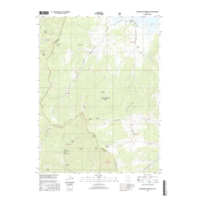
2017 Map of Strawberry Reservoir SW
USGS Topo · Published 2017About this map
Uinta National Forest lands dominate this high-altitude landscape along the border of Wasatch and Utah counties. The northeast corner is marked by the shoreline of Strawberry Reservoir, featuring Renegade Point and the start of the Indian Cr Trail Hollow Loop. The terrain is defined by a series of north-south running ridges and canyons, most notably Strawberry Ridge and Partridge Ridge, which separate the various drainages such as Fifth Water Cr and Indian Cr. The map captures a sophisticated network of back-country routes, including the Center GWT and Tie Fork GWT trails, alongside several forest service roads. Elevations vary significantly across peaks like Baldy Mtn and Little Baldy Mtn, illustrating the complex drainage patterns into the surrounding canyons like Buffalo Canyon and Partridge Canyon.
Find a feature on this map
56 named features on this map. Tap any name to fly to it.
Don’t see what you’re looking for? This feature index may not catch every label — zoom into the map to look around manually.
Map Details
Editions of this 2017 Strawberry Reservoir SW Map
This is the sole edition of this map. No revisions or reprints were ever made.
Other maps of this area

1885 · Salt Lake
USGS Topo · 1:250,000

1885 · Manti
USGS Topo · 1:250,000

1895 · Manti
USGS Topo · 1:250,000

1907 · Strawberry Valley
USGS Topo · 1:125,000

1909 · Strawberry Valley
USGS Topo · 1:125,000

1939 · Soldier Summit
USGS Topo · 1:62,500

1942 · Soldier Summit
USGS Topo · 1:62,500

1954 · Salt Lake City
USGS Topo · 1:250,000

1956 · Price
USGS Topo · 1:250,000

1958 · Salt Lake City
USGS Topo · 1:250,000