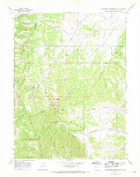
1966 Map of Strawberry Reservoir SW
USGS Topo · Published 1969About this map
Strawberry Ridge and Partridge Ridge dominate this mid-1960s survey of the high country along the Wasatch and Utah County line. The landscape is defined by a dense network of drainage systems, including the numbered Fifth Water Creek through First Water Creek and the winding course of Indian Creek. This area within the Uinta National Forest shows limited human infrastructure beyond the Willow Creek Guard Station and a few specialized sites like a mine and a Borrow Pit. A primitive transportation network of jeep trails, pack trails, and the Treaty Bdy Trail navigates the complex terrain of Buffalo Canyon and Racetrack Hollow. The map reveals the precise intersection of natural topography and administrative boundaries, marking where high peaks like Baldy Mountain overlook deep timbered canyons.
Find a feature on this map
37 named features on this map. Tap any name to fly to it.
Don’t see what you’re looking for? This feature index may not catch every label — zoom into the map to look around manually.
Map Details
Editions of this 1966 Strawberry Reservoir SW Map
3 editions found
Other maps of this area

1885 · Salt Lake
USGS Topo · 1:250,000

1885 · Manti
USGS Topo · 1:250,000

1895 · Manti
USGS Topo · 1:250,000

1907 · Strawberry Valley
USGS Topo · 1:125,000

1909 · Strawberry Valley
USGS Topo · 1:125,000

1939 · Soldier Summit
USGS Topo · 1:62,500

1942 · Soldier Summit
USGS Topo · 1:62,500

1954 · Salt Lake City
USGS Topo · 1:250,000

1956 · Price
USGS Topo · 1:250,000

1958 · Salt Lake City
USGS Topo · 1:250,000