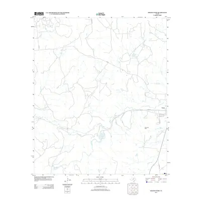
2012 Map of Strawn West
USGS Topo · Published 2012About this map
The western edge of Strawn, Texas, is defined by a network of seasonal watercourses and notable topography. Flowing through the northern reaches, Bills Cr and its tributary S Bills Cr carve through the landscape, while Flat Rock Cr and Cottonwood Cr drain the western sectors. Centrally located, Tucker Lake provides a key hydrological point in this rural area of Palo Pinto County.
Find a feature on this map
20 named features on this map. Tap any name to fly to it.
Don’t see what you’re looking for? This feature index may not catch every label — zoom into the map to look around manually.
Map Details
Editions of this 2012 Strawn West Map
This is the sole edition of this map. No revisions or reprints were ever made.
Other maps of this area

1890 · Stephenville
USGS Topo · 1:125,000

1890 · Breckenridge
USGS Topo · 1:125,000

1891 · Palo Pinto
USGS Topo · 1:125,000

1894 · Eastland
USGS Topo · 1:125,000

1918 · Palo Pinto
USGS Topo · 1:125,000

1920 · Stephenville
USGS Topo · 1:125,000

1954 · Abilene
USGS Topo · 1:250,000

1958 · Abilene
USGS Topo · 1:250,000

1959 · Gordon
USGS Topo · 1:62,500
1965 · Reddy Mountain
USGS Topo · 1:24,000