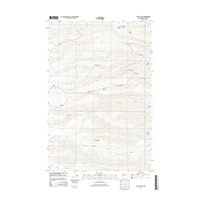
2014 Map of Stray Gulch
USGS Topo · Published 2014About this map
Stray Gulch and the surrounding high-elevation drainage systems of Kittitas County define this portion of the eastern Cascades foothills. In this 2014 landscape, the topography is carved by a dense network of seasonal and perennial waterways including Tarpiscan Cr and its southern fork, as well as several branches of Brushy Cr. These waters originate from high-country sources like Sheridan Spring and Hinkleman Spring, cutting deep landforms such as Lone Pine Canyon and Davies Canyon. The area is navigated by a series of high-altitude gravel routes, most notably Colockum Rd and Brewton Rd, which follow the natural contours of the ridges and gulches. The drainage pattern of Tekison Cr illustrates the complex hydrologic character of this undeveloped terrain, where water movement dictates the placement of early ranching and transport infrastructure.
Find a feature on this map
27 named features on this map. Tap any name to fly to it.
Don’t see what you’re looking for? This feature index may not catch every label — zoom into the map to look around manually.
Map Details
Editions of this 2014 Stray Gulch Map
This is the sole edition of this map. No revisions or reprints were ever made.
Other maps of this area

1912 · Malaga
USGS Topo · 1:48,000

1913 · Wenatchee
USGS Topo · 1:62,500

1914 · Malaga
USGS Topo · 1:62,500

1915 · Wenatchee
USGS Topo · 1:62,500

1920 · Colockum Pass
USGS Topo · 1:125,000

1922 · Colockum Pass
USGS Topo · 1:125,000

1957 · Wenatchee
USGS Topo · 1:250,000
1966 · Colockum Pass SE
USGS Topo · 1:24,000
1966 · Colockum Pass
USGS Topo · 1:24,000
1966 · Cape Horn SE
USGS Topo · 1:24,000