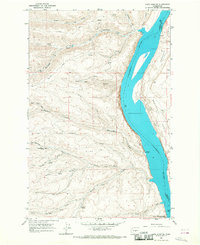
1966 Map of Cape Horn SE
USGS Topo · Published 1968About this map
Columbia River waters dominate the eastern edge of this landscape, separating the high plateaus of Kittitas County from Grant County. Along the river's western bank, the small settlement at Scammon Landing and the southern reaches of Ginkgo Petrified Forest State Park provide evidence of early recreational and scientific interest in the region's unique geology. The terrain is deeply incised by a series of drainages, including Quilomene Creek, Whiskey Dick Creek, and Box Canyon, which flow eastward from the high ridges down toward the river.
Find a feature on this map
24 named features on this map. Tap any name to fly to it.
Don’t see what you’re looking for? This feature index may not catch every label — zoom into the map to look around manually.
Map Details
Editions of this 1966 Cape Horn SE Map
Other maps of this area

1909 · Quincy
USGS Topo · 1:62,500

1910 · Quincy
USGS Topo · 1:62,500

1912 · Beverly
USGS Topo · 1:62,500

1920 · Colockum Pass
USGS Topo · 1:125,000

1922 · Colockum Pass
USGS Topo · 1:125,000

1939 · Boylston
USGS Topo · 1:48,000

1943 · Boylston
USGS Topo · 1:62,500

1950 · Yakima
USGS Topo · 1:250,000

1953 · Ginkgo
USGS Topo · 1:24,000
1953 · Boylston
USGS Topo · 1:24,000