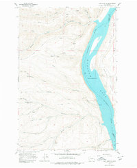
1966 Map of Cape Horn SE
USGS Topo · Published 1980About this map
Wanapum Lake Columbia River dominates the eastern half of this landscape, its banks defined by the steep elevation changes of Babcock Bench to the east and a network of drainages to the west. In the mid-1960s, the terrain was primarily accessed via an Army Road and numerous jeep trails that threaded through deep cuts like Box Canyon and along the Skookumchuck Creek. Along the shoreline, Scammon Landing marks a point of river access, while the southern edge of the sheet transition into the Ginkgo Petrified Forest State Park. Evidence of local industry appears at Silica and a nearby Borrow Pit, reflecting the area's geological utility. The map's labeling includes numerous family-named landmarks such as Perkins and Hartman, which provide valuable location data for researchers tracing land use in this part of Kittitas and Grant counties.
Find a feature on this map
33 named features on this map. Tap any name to fly to it.
Don’t see what you’re looking for? This feature index may not catch every label — zoom into the map to look around manually.
Map Details
Editions of this 1966 Cape Horn SE Map
Other maps of this area

1909 · Quincy
USGS Topo · 1:62,500

1910 · Quincy
USGS Topo · 1:62,500

1912 · Beverly
USGS Topo · 1:62,500

1920 · Colockum Pass
USGS Topo · 1:125,000

1922 · Colockum Pass
USGS Topo · 1:125,000

1939 · Boylston
USGS Topo · 1:48,000

1943 · Boylston
USGS Topo · 1:62,500

1950 · Yakima
USGS Topo · 1:250,000

1953 · Ginkgo
USGS Topo · 1:24,000
1953 · Boylston
USGS Topo · 1:24,000