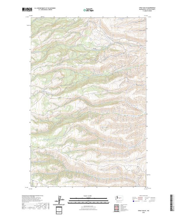
2023 Map of Stray Gulch
USGS Topo · Published 2023About this map
Colockum Game Range dominates this landscape in Kittitas County, where a complex drainage network defines the land between the Columbia River and the high interior. The map reveals an intricate system of canyons and water sources, including the headwaters of Tarpiscan Creek and the South Fork Tarpiscan Creek. For those studying the hydrology of the region, the location of remote watering points such as Sheridan Spring and Hinkleman Spring provides essential context for land use in this protected wildlife area.
Find a feature on this map
19 named features on this map. Tap any name to fly to it.
Don’t see what you’re looking for? This feature index may not catch every label — zoom into the map to look around manually.
Map Details
Editions of this 2023 Stray Gulch Map
This is the sole edition of this map. No revisions or reprints were ever made.
Other maps of this area

1912 · Malaga
USGS Topo · 1:48,000

1913 · Wenatchee
USGS Topo · 1:62,500

1914 · Malaga
USGS Topo · 1:62,500

1915 · Wenatchee
USGS Topo · 1:62,500

1920 · Colockum Pass
USGS Topo · 1:125,000

1922 · Colockum Pass
USGS Topo · 1:125,000

1957 · Wenatchee
USGS Topo · 1:250,000
1966 · Colockum Pass SE
USGS Topo · 1:24,000
1966 · Colockum Pass
USGS Topo · 1:24,000
1966 · Cape Horn SE
USGS Topo · 1:24,000