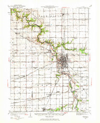
1925 Map of Streator
USGS Topo · Published 1973About this map
The Vermilion River carves a deep, winding path through this Illinois landscape, anchoring a region defined by a dense network of rail lines and rural community centers. In the mid-1920s, Streator serves as a major industrial and transit hub, where the Chicago and Alton and New York Central lines converge. The surrounding townships, including Grand Rapids and Farm Ridge, are dotted with family-named landmarks and one-room schoolhouses like Paddy Ridge School and Essick School. Social life centers on local congregations such as St Andrews Church and the German Methodist Church. Topographical details reveal significant river crossings at Sandy Ford and Klein Bridge, alongside specialized sites like the St Casimirs Cem and Coalville School, reflecting the era's settlement patterns and coal-driven economy before modern highway expansion shifted the local geography.
Find a feature on this map
98 named features on this map. Tap any name to fly to it.
Don’t see what you’re looking for? This feature index may not catch every label — zoom into the map to look around manually.
Map Details
Editions of this 1925 Streator Map
2 editions found
Other maps of this area

1892 · Marseilles
USGS Topo · 1:62,500

1892 · Ottawa
USGS Topo · 1:62,500

1893 · Lasalle
USGS Topo · 1:62,500

1911 · La Salle
USGS Topo · 1:62,500

1913 · La Salle
USGS Topo · 1:62,500

1915 · Ottawa
USGS Topo · 1:62,500

1916 · Marseilles
USGS Topo · 1:62,500

1925 · Streator
USGS Topo · 1:62,500

1927 · Streator
USGS Topo · 1:62,500

1934 · Wenona
USGS Topo · 1:48,000