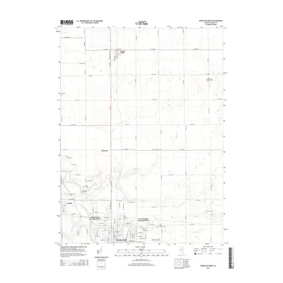
2015 Map of Streator North
USGS Topo · Published 2015About this map
Streator and its northern surroundings are defined by the winding course of the Vermilion River and a dense network of local creeks. The landscape is a mix of urban development and rural township grids, including the Delbert Egan Housing Project and Evans Heights Housing Project on the northern edge of the city. Notable for its concentration of small family and denominational burial grounds, the area includes sites like Saint Casimir Cem, Hillcrest Memorial Cem, and Saint Anthony Catholic Cem. Small settlements such as Kangley, Richards, and Grand Ridge dot the countryside, connected by an extensive grid of numbered township roads. The map also features Rothrock Airport and several prominent drainage systems including Otter Creek, Wolf Creek, and Prairie Cr, which carve through the relatively level Illinois prairie.
Find a feature on this map
85 named features on this map. Tap any name to fly to it.
Don’t see what you’re looking for? This feature index may not catch every label — zoom into the map to look around manually.
Map Details
Editions of this 2015 Streator North Map
This is the sole edition of this map. No revisions or reprints were ever made.
Other maps of this area

1892 · Marseilles
USGS Topo · 1:62,500

1892 · Ottawa
USGS Topo · 1:62,500

1915 · Ottawa
USGS Topo · 1:62,500

1916 · Marseilles
USGS Topo · 1:62,500

1925 · Streator
USGS Topo · 1:62,500

1927 · Streator
USGS Topo · 1:62,500

1940 · Marseilles
USGS Topo · 1:62,500

1946 · Ottawa
USGS Topo · 1:62,500

1958 · Odell
USGS Topo · 1:62,500

1958 · Aurora
USGS Topo · 1:250,000